


For buyers, investors, and cottage seekers considering French River vacant land in Northeastern Ontario, success comes from understanding how northern waterfront markets work, what zoning will allow, and the practical realities of building in Canadian Shield country. The French River corridor sits roughly between Lake Nipissing and Georgian Bay, with pockets of private, municipal, and Crown lands, plus sensitive shoreline and habitat protections. Below is a grounded, Ontario-specific overview to help you evaluate lots confidently.
French River at a glance: location, access, and market character
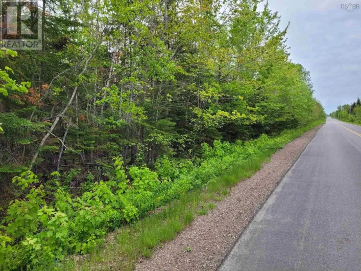
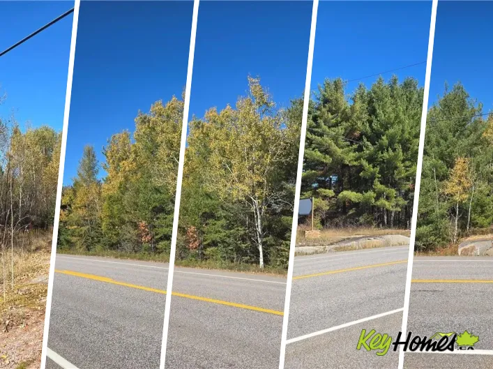
The Municipality of French River encompasses communities like Noelville and Alban along Highway 69/400, within driving distance of Sudbury (about an hour) and the GTA (3.5–4.5 hours depending on the lot). Many properties are either waterfront on the French River or its channels, near inland lakes, or rural acreage backing onto Crown land. Access types vary:
- Year-round municipal road access (best for financing and resale)
- Private/seasonal roads with road maintenance agreements (critical for winter plowing and lender comfort)
- Water-access-only lots (affecting financing, services, and insurance)
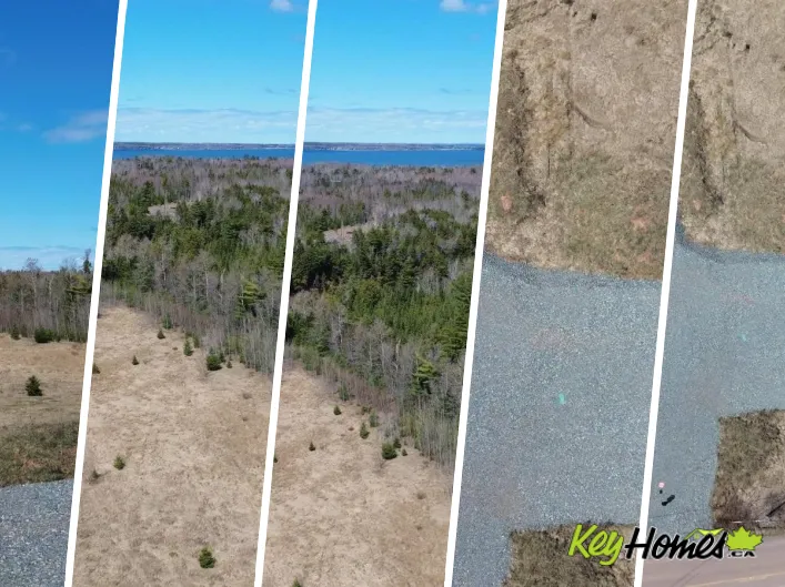
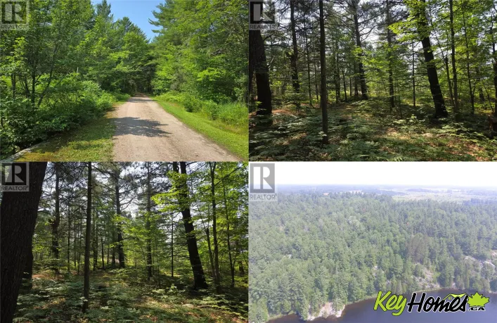
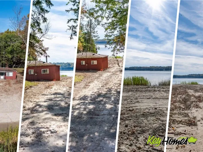
Waterfront terrain is typically rocky with mixed forest, ledge outcrops, and variable shorelines—ranging from deep water with quick drop-offs to gentle, marshy bays. Exposure, boatability (some segments connect towards Georgian Bay), and privacy influence price and future marketability.
Zoning and land-use for French River vacant land
Zoning is administered locally—primarily through the Municipality of French River and the Sudbury East Planning Board. Typical designations include Waterfront Residential (WR), Rural (RU), Agricultural (A), or commercial/recreational zones. Always obtain the current zoning map, permitted uses, and setbacks in writing, as regulations can change and may differ between waterfront and inland parcels.
Shoreline rules, setbacks, and site plan control
Waterfront areas commonly require substantial setbacks from the high-water mark (often in the 30 m/100 ft range), vegetation protection, and limits on lot coverage. Many Ontario municipalities use Site Plan Control for waterfront development to manage drainage, shoreline buffers, and dock locations. In French River, verify whether your lot is under site plan control and whether a shore road allowance lies between your deeded property and the water—purchasing/closing a shore road allowance can add cost and time if you plan structures close to the shoreline.
Trailers, bunkies, and temporary uses
Seasonal use of trailers or bunkies on vacant land is often constrained. Even small structures under 10 m² (108 sq. ft.) that might not require a building permit still need to comply with zoning and setbacks, and cannot be used as dwellings. If you plan to camp on your land before building, check French River's specific rules and whether a temporary use bylaw or permit exists.
Crown land, mineral rights, and First Nations considerations
- Crown land adjacency: Great for privacy, but verify boundaries and any access rights. Confirm whether any part of the lot includes Crown shoreline or patented vs. unpatented segments.
- Mineral/aggregate rights: In Ontario, surface and mineral rights can be severed. A title search should confirm what you're purchasing and whether active claims or nearby pits/quarries exist.
- First Nations lands and consultation: Portions of the French River region border or include First Nations territories (e.g., Dokis). Development permits off-reserve can still trigger heritage/archaeological review; on-reserve purchases are typically leasehold with different financing and rules.
Building feasibility: services, terrain, and approvals
Septic and water: On most rural lots, you'll rely on a drilled well and a private septic system under Part 8 of the Ontario Building Code. In the French River area, building/sewage permits are administered locally (through municipal building services) with site-specific soil and setback requirements. On rocky sites, expect engineered systems or blasting to meet septic bed requirements; shallow soils over bedrock can raise costs.
Electricity and internet: Hydro One services much of the region. Line extensions can be expensive if poles must be added—obtain a written estimate early. Data coverage varies; some buyers use satellite or fixed wireless providers for reliability.
Driveways and blasting: Canadian Shield topography can make driveways, foundations, and septic beds costlier than in southern Ontario. Simple improvements like selective tree removal and a properly ditched driveway can materially improve resale value by showcasing buildable area.
Shoreline work, docks, and habitat
Altering shorelines or installing docks may require approvals under the Public Lands Act, Fisheries Act, and local policies. Even if there's no conservation authority jurisdiction on your specific parcel, provincial and federal rules still apply. Assume that dredging, infilling, or extensive shoreline alteration will require permits—avoid work until you've confirmed the pathway with municipal staff and, where applicable, the Ministry of Natural Resources and Forestry.
Financing, taxes, and carrying costs
Vacant land financing: Big banks often require 35–50% down on unserviced vacant land, and more for water-access-only. Credit unions or vendor take-back mortgages may be more flexible. A plausible scenario: 40% down on a year-round road-access waterfront lot with proof of build intent within 24–36 months. Serviced or partially improved lots (e.g., driveway, hydro at lot line, approved septic) can expand your lender pool.
HST: Whether HST applies depends on the seller and intended use. A private sale of a rural residential building lot by an individual may be exempt; serviced lots from a builder are typically subject to HST. Always have your lawyer confirm.
NRST (foreign buyer tax): Ontario's Non‑Resident Speculation Tax applies province‑wide and can capture vacant land zoned for residential use. If you're a non‑resident considering a WR or residentially zoned parcel, assess eligibility for exemptions/rebates with your lawyer before waiving conditions.
Ongoing costs: Property taxes are generally modest for raw land but vary with waterfront footage and improvements. Owners with larger, forested acreage can explore the Managed Forest Tax Incentive Program (MFTIP) if eligible.
Seasonal market trends and pricing patterns
Inventory tends to rise in spring, with peak showings in late spring through summer when water access is easiest and bugs diminish. Fall can offer motivated sellers aiming to avoid winter carry costs. Winter purchases sometimes yield better pricing, but inspections are more limited (frozen ground hides drainage issues; private roads may be unplowed). Year-over-year, buyer demand often tracks fuel prices, interest rates, and GTA migration patterns—French River benefits from improved Highway 69/400 access compared to more remote northern markets.
French River vacant land: lifestyle and rental lens
Lifestyle draws include world-class boating and fishing, snowmobile trail networks, and a quieter, low-density cottage feel relative to Muskoka. For investors, short-term rental (STR) viability is not guaranteed: many northern municipalities—French River included—have reviewed or enacted STR policies or licensing in recent years. Regulations vary by zone, septic capacity, parking, occupancy, and fire safety. Verify current rules if rental income is part of your underwriting.
Resale potential: what future buyers will pay for
- Access certainty: Year-round municipal road access and a registered road maintenance agreement (if private) are major value drivers.
- Build clarity: A current survey, lot grading concept, and septic/well feasibility can lift buyer confidence.
- Shoreline quality: Deep, swimmable frontage with favourable exposure and minimal marsh typically commands premiums.
- Noise and use conflicts: Proximity to hydro lines, busy channels, or public launch sites can affect tranquility; due diligence matters.
Example scenarios
Investor buyer: Targets a 2–3 acre WR lot with 200+ feet of frontage, year-round access, and moderate topography. Budgets for a drilled well and tertiary septic due to shallow soils, and confirms STR licensing before underwriting. Structures plans so that vegetation buffers remain intact to streamline site plan approval.
End-user cottage builder: Chooses slightly back from the main channel for calmer waters. Accepts a longer driveway through rock knobs and gets a hydro quote up-front to avoid surprises. Adds a small storage shed (per zoning) only after receiving written municipal confirmation.
Regional notes, data points, and comparable research
Comparable sales can be sparse, especially for unique waterfront. It helps to benchmark against other Canadian cottage and land markets while adjusting for access, services, and local bylaws. National resources like KeyHomes.ca maintain cross-regional snapshots—from waterfront land on the Ottawa River to Nanaimo vacant land trends—to help you gauge replacement options and opportunity cost. Even urban and prairie land pages, such as vacant land in Oakville and vacant land in Lethbridge, can inform how lenders and appraisers think about access, servicing, and time-to-build.
Cross-regional inventory also highlights adaptive re-use and niche strategies. For example, KeyHomes.ca tracks specialized assets like repurposed church listings and former church properties, as well as smaller-town markets including markets like New Waterford or Florenceville market snapshots. While these aren't substitutes for French River comparables, they help investors understand liquidity and buyer pools across regions. Likewise, tracking multi-residential and condo segments—such as condo activity in Dieppe and apartments in Dieppe—can provide context on yield expectations and alternative placements of capital when you're weighing raw land vs. income property.
Due diligence checklist for French River buyers
- Zoning & setbacks: Get a zoning compliance letter; confirm site plan control, shoreline buffers, and trailer rules.
- Access & maintenance: Verify year-round status; obtain a copy of any road agreement; ask insurers about winter access implications.
- Survey & title: Order an Ontario Land Surveyor Real Property Report if none exists; confirm mineral rights and any easements or shore road allowances.
- Environmental & habitat: Screen for species at risk (e.g., Blanding's turtle) and archaeological potential; avoid any shoreline work until you confirm approvals.
- Septic & well feasibility: Engage local installers early; expect engineered solutions on shallow soils or steep slopes.
- Utilities: Obtain a written Hydro One estimate for line extensions; test cell/data coverage on site.
- Financing: Pre-negotiate with lenders; water-access-only or unserviced lots require higher down payments and stricter terms.
- Taxes & levies: Confirm HST status, Ontario LTT, and whether NRST applies to your situation; ask about development charges.
- STR viability: If renting is part of the plan, verify licensing, occupancy limits, and fire code requirements.
- Seasonal access: Visit in spring or after heavy rain to check drainage; winter showings can hide constraints.
Where to research and compare
Beyond local municipal offices and building departments, KeyHomes.ca is a useful hub to explore listings, review market snapshots, and connect with licensed professionals who regularly transact in northern Ontario and similar cottage-country markets. National datasets—spanning cottage waterfronts to urban infill land—offer perspective when pricing unique parcels in the French River area.